5.1. Create OcTree Mesh
Here, the code create_octree_mesh_e3d_v2_tiled.exe and the input file octree_mesh.inp (see format) are used to create an OcTree mesh based on the set of observation location and surface topography. Files relevant to this part of the example are in the sub-folder octree_mesh. Before running this example, you may want to do the following:
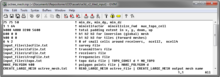
To generate the OcTree mesh, the following input file was used:
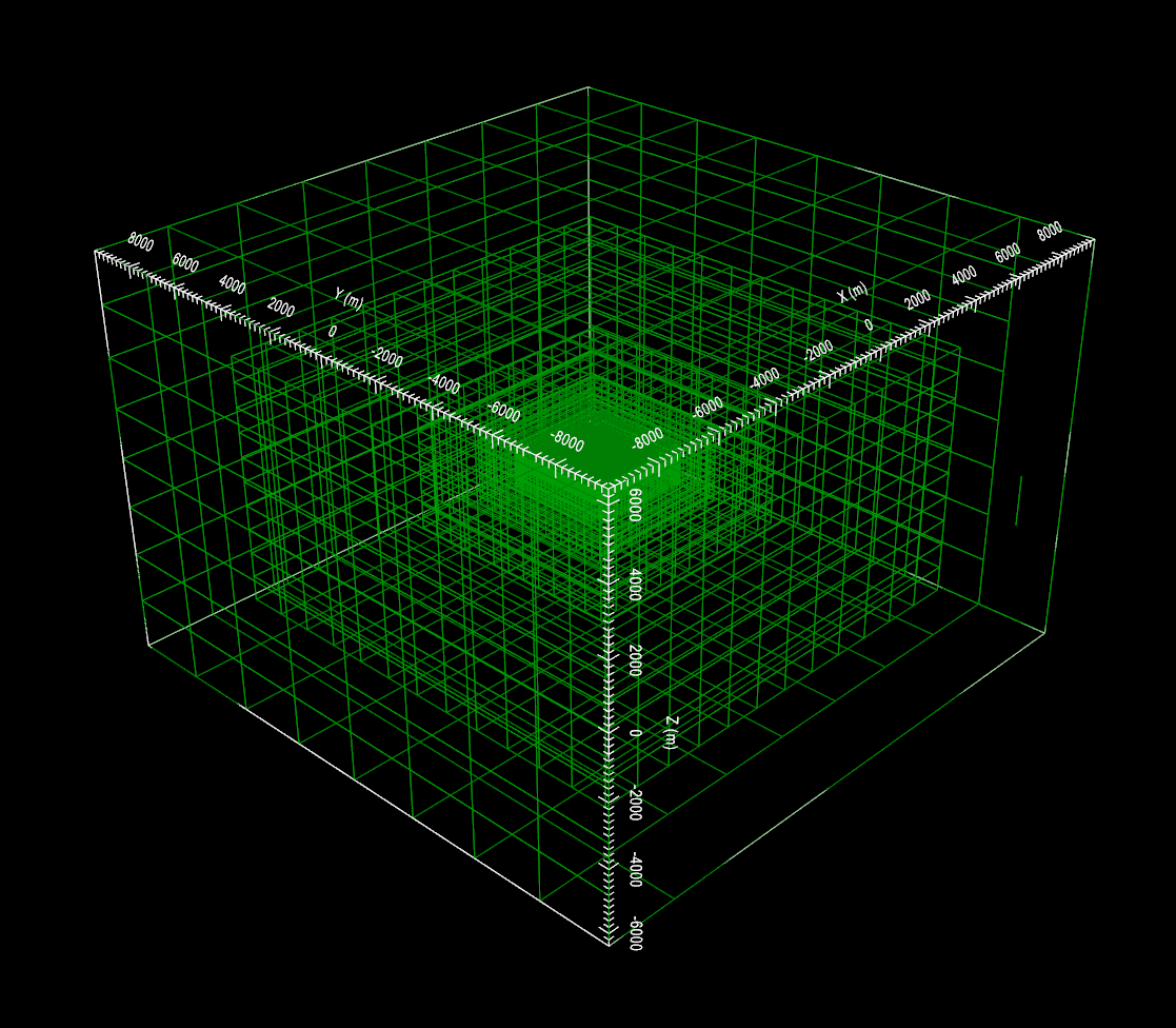
To keep the problem simple, the topography is given a constant elevation of 0 m. The resulting OcTree mesh is shown below: